

Portal into the Ancient Depths of the Bahamas
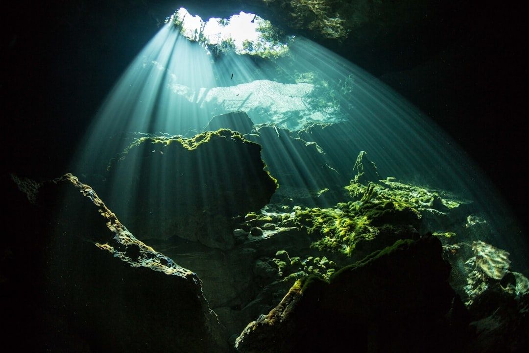
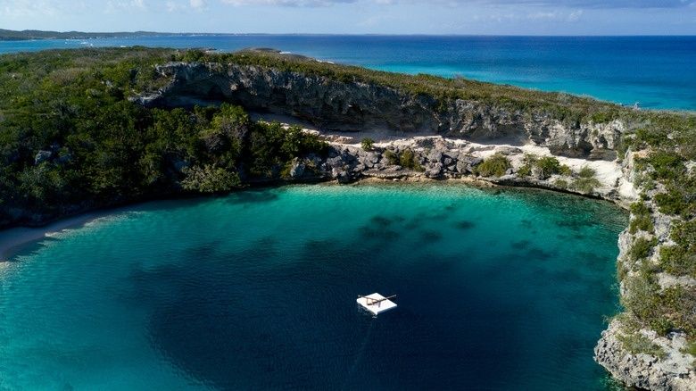
Across the Bahamian pine barrens, the surface can appear wonderfully undramatic: pale limestone underfoot, resinous woodland, birds moving through coppice, and a quiet pool reflecting the sky. Yet beneath some of those inland waters lies a far larger landscape. Blue holes are entrances into flooded karst systems, where shafts, chambers, tunnels, and submerged passages extend through limestone formed and reshaped over immense spans of time.
These places are more than striking swimming spots or adventurous dive sites. They are geological records of changing climates, when ice sheets locked away seawater, sea levels fell, and parts of the Bahama Banks became dry land. Rainwater then dissolved the exposed carbonate rock, opening caverns that later filled as the oceans rose again. For coastal travelers and natural history enthusiasts, the invitation is to look closely while treading lightly. The calm surface is beautiful precisely because it protects a fragile archive below.
When the Ocean Receded Across the Bahama Banks
During the coldest stages of the Pleistocene, enormous ice sheets accumulated across North America and other high-latitude regions. Water held in those glaciers was temporarily removed from the oceans, causing global sea levels to fall by hundreds of feet. The Bahama Banks, built largely from porous carbonate limestone, were consequently exposed over broad areas. Formerly submerged platforms became dry landscapes, and coastal shorelines shifted far beyond their present positions.
Once exposed, the limestone was worked by rainwater rather than by waves alone. Rain absorbed carbon dioxide from the atmosphere and soil, forming a weak carbonic acid that seeped through cracks and widened natural joints. Over thousands of years, this chemical dissolution produced sinkholes, vertical shafts, underground canyons, and chambers. The karst landscape seen today is therefore the product of repeated interaction between rock, water, climate, and changing sea level.
In the dry phases, mineral-rich water also moved slowly through cavern roofs and floors. Drop by drop, calcite accumulated into stalactites hanging from ceilings and stalagmites rising from the ground. Some formations developed in darkness long before the chambers were flooded. Later sea-level oscillations submerged the caves, preserving many of these features beneath freshwater, brackish water, or saltwater. Detailed sedimentological work catalogued through the University of Miami Research Portal helps place Bahamian carbonate landscapes within the longer history of Pliocene and Pleistocene deposition, erosion, and alteration.
The Anatomy of Stratified Vaults Beneath the Surface
A typical inland blue hole is not simply a freshwater pond with a deep bottom. It can contain a layered water column shaped by density. Rainwater percolating through the limestone forms a freshwater lens, which is generally less dense than the saltwater connected to the surrounding sea. Where those waters meet, a halocline develops. Visibility may change abruptly there, and even a gentle movement can make the boundary shimmer or appear to dissolve.
Below the halocline, decaying leaves and other organic matter can consume available oxygen. In deeper, stiller sections, microbial processes may produce hydrogen sulfide, creating dark, oxygen-free conditions that are hostile to many ordinary surface organisms but unusually favorable for preserving organic remains. Hydrogeological investigations, including the research detailed in Mylroie and Carew”s study on Bahamian karst geomorphology, are useful reminders that density barriers can limit vertical mixing within flooded karst networks.
| Layer | Typical character | Why it matters |
|---|---|---|
| Freshwater lens | Rain-fed, relatively light, and often clearer near the surface | Connects the blue hole to the island”s groundwater system |
| Halocline | A sharp transition between fresh and saline water | Limits mixing and changes visibility, buoyancy, and chemistry |
| Saline lower water | Densely connected with marine groundwater | Reflects the relationship between inland caves and the sea |
| Anoxic zone | Oxygen-depleted and sometimes hydrogen-sulfide-rich | Can slow decomposition and preserve bones, wood, pollen, and other material |
The resulting stillness is part of the blue hole”s protective power. Unlike an open reef or exposed shoreline, deep chambers are not continually swept by waves and tides. Delicate mineral formations can remain intact, while sediments settle in quiet layers. At the same time, this stability makes contamination especially serious. A small amount of fuel, sunscreen, litter, or disturbed sediment can persist in an enclosed water system and move through connected groundwater.
Submerged Time Capsules and the Fossil Vaults of Sawmill Sink
Sawmill Sink on Great Abaco Island offers one of the clearest examples of what these environments can preserve. Researchers investigated the site for more than a decade beginning in 2005 and recovered thousands of fossils. The water”s darkness, salinity, tannins, and lack of oxygen slowed the processes that normally break down bone and other organic material. Difficult underwater passages also reduced access, limiting both natural disturbance and casual human interference.
The evidence indicates that Abaco was once roughly ten times larger during periods of lower sea level. What is now a flooded blue hole was previously a dry sinkhole within a much broader island landscape. Animals could move across exposed land, and vegetation occupied areas later claimed by the sea. As the last glacial period ended and oceans rose, the island became smaller and the sinkhole flooded, creating a submerged archive of ecological change.
The collection includes remains that help trace both natural climate-driven shifts and later human influence. Finds associated with Sawmill Sink include extinct giant tortoises, crocodilians, birds, bats, hutia, ancient plants, and other organisms. Together, they show how island biodiversity changed as habitats contracted, coastlines moved, and new pressures appeared after people arrived.
- Giant tortoises reveal the presence of large herbivores on the former dry island.
- Crocodilian remains point to ancient wetland and freshwater environments that no longer exist in the same form.
- Bird and bat fossils help reconstruct woodland, shoreline, and cave communities.
- Hutia remains document an important native mammal group affected by later environmental and human changes.
- Plant material and pollen offer clues about vegetation, rainfall, and habitat transitions through time.
The preservation story also carries a modern warning. Hurricane Dorian destroyed the natural history museum created to interpret the collection in 2019, although approximately 80 to 90 percent of the material survived and much was moved into climate-controlled storage at the University of Florida. The South Abaco Blue Holes Conservation Area provides important protection, but wider national-park plans have remained stalled, and researchers believe substantial discoveries are still underwater.
Gentle Protocols for Experiencing Fragile Aquatic Karst Systems
Blue holes reward preparation more than spontaneity. On Andros Island, Blue Holes National Park was established in 2002 and protects 40,000 acres of pine forest and coppice along with 22 inland blue holes. Among the best known is Captain Bill”s Blue Hole in Central Andros, where visitor infrastructure has included a forest footpath, a boardwalk, changing facilities, a dock, and an elevated wooden jumping platform. Swimmers venturing into inland sites like Captain Bill’s must remember that freshwater is significantly less buoyant than seawater. While the Bahamas National Trust oversees these habitats, facility hours and site maintenance can fluctuate, so travelers should confirm the current access status and safety protocols with the Trust or local guides before heading into the pine barrens.
Great Abaco presents a distinctly different visitor landscape. Marsh Harbour is a practical logistics base for provisioning and arranging travel across the mainland and cays, but Abaco”s inland karst features do not generally cater to casual swimming crowds. World-renowned sites in South Abaco such as Dan”s Cave, Ralph”s Cave, and Sawmill Sink are delicate, highly complex underground labyrinth systems strictly reserved for advanced technical cave divers or scientific teams. For everyday visitors seeking an accessible inland dip on Abaco, spots like the Treasure Cay Blue Hole in the north offer a natural opening, though they lack developed jumping decks or commercial amenities. Divers exploring Abaco’s flooded passages encounter severe haloclines, total darkness, and fragile speleothems that require specialized trimix and cavern certifications.
- Check access first. Confirm whether the site, trail, boardwalk, or protected area is open, and follow instructions from the Bahamas National Trust, park staff, landowners, and qualified local guides.
- Arrive sun-smart and self-sufficient. Carry drinking water, sun protection, sturdy footwear, and any required safety equipment. Do not assume that a remote inland site has a staffed facility or reliable mobile coverage.
- Keep the water clean. Avoid fuel, litter, food scraps, harsh chemicals, and unnecessary sunscreen before entering freshwater. Never wash equipment or vehicles in or beside a blue hole.
- Protect the edges. Stay on established trails and boardwalks, avoid trampling vegetation, and do not move rocks, fossils, stalactites, stalagmites, or submerged objects.
- Choose the right activity level. Non-divers should swim only where local guidance permits. Cave diving should be limited to properly trained technical divers using redundant equipment, formal dive plans, and an experienced team.
- Leave wildlife undisturbed. Do not feed cave fish, handle animals, collect specimens, or enter restricted passages. A photograph and careful observation are the appropriate souvenirs.
These habits protect more than the attraction itself. Freshwater lenses support surrounding pine and coppice ecosystems, and karst aquifers can transmit pollutants quickly through cracks and conduits. A considerate visitor therefore protects birds above the pool, invertebrates below it, and communities that depend on clean groundwater.
Step Lightly Where Ancient Earth Whispers
The blue holes of the Bahamas connect several kinds of time. Their limestone records ancient seas, their mineral formations mark long dry intervals, and their water chemistry preserves traces of animals and plants that lived before modern coastlines took shape. Sawmill Sink makes that continuity especially tangible: a place that was once part of a broad terrestrial island became a flooded chamber holding evidence of vanished habitats.
For travelers, the most meaningful encounter is not necessarily the deepest dive or the boldest jump. It is the recognition that a quiet inland pool may be a national scientific treasure. Support protected areas, book responsibly with local guides, respect temporary closures, and contribute to conservation-minded businesses and community stewards. Beneath the island pace, these submerged architectures are still recording change. They deserve the same care given to any irreplaceable monument, with the added understanding that their most important rooms may remain hidden from view.